
Thursday, May 14: Spent the night last night at a very nice little B & B just outside of Confluence, the Stepping Stones Farm B&B. Larry did a wonderful job of making us feel at home. Tell ya what, just doing this gig day after day makes us a couple of real party pooprs, Trouble is that we just didn’t have the opp. to enjoy our stay there, cuz we hit the hay before 10 Pm and were up at 6 AM so I could work a few hours prior to riding. So really we were just there for nothing more than a sleep and breakfast. Larry was good enough to get up early to have coffee on for Judy at 6 AM and cook us breakfast at 7. Had a wonderful breakfast then we were on our way back into town for the day’s start. Now the morning temp, on May 14 down here was a frigid 36 degrees! This one kicked the heck out of yesterday’s low. BUT with a cloudless, sunny sky this morning it just felt 20 degrees warmer than yesterday with those cold winds and the cloudy, drizzly sky. Wore the same get-up as yesterday.
Got on the trail by 8:30 and was kind of melancholy due to the fact that I’d be leaving this really beautiful trail within an hour and a half. This has to be one of my favorite little get-away destinations to just relax on a bike and enjoy the sights and sounds of the mts of SW PA. Plus, I didn’t relish the fact that I would be back to busting my butt on old RR grades, baseball sized ballast, and crazy ATC tracks. Yea, it was a case of getting back to reality. The first stop would be Ohiopyle, about 11 miles north. Now Judy and I have been really trying to coordinate the support side of this, such that she’d NOT have any more incidents. So I did even more homework last night on the mapping to get her to the right place in one piece.
Trouble is that some of these roads have like 3 different designations. Take for instance State Rt 281…it’s also labeled as SR2012 and called Sugar Loaf Rd. So this is the stuff we’re up against. One sign may say one thing, and 10 miles up the road it’s got a local name, then 10 miles later it’s a county designation. So as I’m giving Judy directions Sometimes I just don’t cover all the potential names of the roads. Well, I got bit in the ass yet again, because the 281 thing, well it was labeled as Sugar Loaf Rd. So she was off track looking for where 281 went when indeed she was on the right road all the time. I ended up getting to Ohiopyle before her, so again, my heart stated the tachycardia thing with me stressing out about where she was, especially when I couldn’t get my cell calls through to her.
I rode around town real quick, thinking that maybe she parked somewhere else and had no cell service, but to no avail. So I just went back up to the trailhead, which we both have been to at least three prior times, and waited. She ended up pulling in about 15 min later, relating to me how the directions I gave her were wrong. Well, they weren’t, the roads just were not labeled as I had read them off from google map. So as I tried to explain to her the next support stop, in Uniontown, she was just totally wigged out about getting lost again. And I’ll have to admit that having been bitten so many times thus far with wrong roads and road designations, I was a bit wigged to. I mean this getting lost thing was beginning to become a daily event, and I feel helpless out there not knowing where she might be. So I went over the next set of directions, 2, 3, 4 times. And she still didn’t feel good.
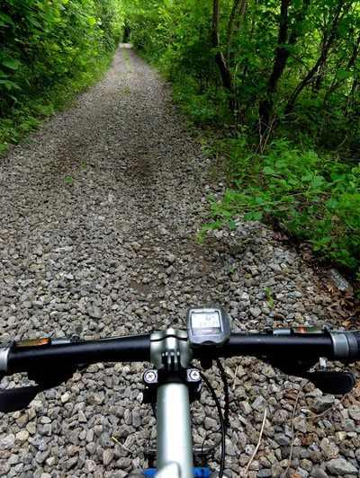
But, we just had to go with it. Off I went up the trail for my last 15 miles of the GAP trail up to Dunbar. I was able to really cruise, probably doing about 14-15 mph on a very concrete-like hard packed crushed limestone trail. Dropped the long sleeve insulated jersey and the gloves and ear warmers a couple miles in. The morning was just stellar, which made my leaving the GAP feel even worse. Could have just ridden all the way to Pittsburgh. But, had to take my cut-off, the Sheepskin Trail, and begin to work my way to the southwest. The Sheepskin is the beginning of what might be a very long trail someday going southwest to Point Marion, covering the areas that I will be riding some gnarly undeveloped old RR line. It’s just developed for 2 miles, and then….you’re back to getting beat up in a big way.
Once the Sheepskin ends, the old remnants of the line are still there, and have been used by ATC, ATV and motoX guys, creating this massive track all the way to Uniontown. I mean this track has been dug down into the old coal ballast a good 4 feet in sections. It’s like riding inside a trail, with ups and downs and whoopdedos and all sorts of hazards. There are sections where it goes right out along an active line. I mean it’s so obvious and blatant that when I discovered it last year, I had to ask some motorcycle guys about the legality of doing it. They told me no one had ever hassled them about it. And as I began today on this thing, a couple of ATC guys came screaming down the track. I just pulled off to the side and let them come through. The only hazard of riding this thing on a bike, up as high as I was on that 29er, was that I’d get swatted by branches and prickers on occasion.
Made good time, but do get a soaker as I had to X a slippery, steep little stream and I bike walked it. Then, when the trail swung out along the active line, I was a bit nervous, but man, the furloughs that all the ATC guys had burned into the ballast, I just went in head first. These track just X roads left and right and continue all the way to Uniontown. So I got a call from Judy and she’d told me that she was in Uniontown and ok, waiting at a place just a block from where we had talked about as the support stop. With that taken care of I felt pretty good about nailing the rest of this thing. Made it into Uniontown about 45 min ahead of schedule. And it was crazy, but this ATC track went right into the city. I mean RIGHT into this pretty big city.
Once it did enter the city I was able to ride on gravel that was adjacent to the active RR line and kind of NOT be ON the line. Then the RR went by a park so I just rode on the grass several blocks and hooked up with Judy. Ate a piece of Za left over from last night, then added a banana, blue berries and a cold can of coke. Ditched all my cold weather gear, and then got to work explaining the next support stop, and again Jude was wary of my explanation. And hell, couldn’t blame her after all the gaffs. But I did my best and sucked it up for a section that I just didn’t relish, going through the rest of town along the RR and then riding on some active line because the old RR line adjacent to it was devoid of ATC track in many places. This was the grunt I was not too fond of.
Actually made it through town just by riding on this gravel apron that was between the RR line and the businesses, many of which had gravel parking areas along the RR line. So I was “kind” of cool about staying off pavement just by riding these gravel lots abutting the RR. Then the tough part came out of town way out in the country - riding down the middle of the RR line because the old, abandoned line was just piecemeal or nonexistent in places with respect to the ATC tracks. Now let me say that this line, though it’s next to a defunct, vacated Baltimore and Ohio line, is used on occasion. It’s actually a dead end line with no thru rail traffic. It just serves a few sand and gravel plants and a grain silo. I guess that’s why the motor heads use it so much, because even when there wasn’t the track in the woods on the defunct line, there were double tracks right next to the RR line that are used all the time. Trouble is that they are on really loose, softball sized ballast, and they’re a real bitch to ride a bike on. It’s like biking on giant marbles. I mean the concentration is supreme riding on that stuff. So after riding this stuff for 20 minutes I decided to ride right down the middle of the tracks - and suddenly I was flying, in the big ring, doing like 10 mph. All this was due to the fact that the ballast between the ties was even with the ties, which made for a really good surface.
I was just cruising, making good time. I’d X a road, or pass a guy cutting the lawn and just wave, and they all smiled and waved back to me, probably thinking I was some kind of nut. That’s when I got a call from Judy telling me she couldn't find our next support stop. I did my best to walk her through it, even taking out my gps and running through the roads, but she didn’t know where she was - which made my job even tougher. Finally told her to just ask someone and we left it at that. Then back on the RR to ramble down the middle. Made it to our designated support stop and no Judy. So I called, only to find that she knew where she was, but it would take her 25 minutes to get to me.
Told her to just go as far as Smithfield and I’d meet her there - seeing that that’s where the line dead ended. Made it to Smithfield in super fast time on the Von Ryan’s Express. Once the RR line hits Smithfield it just ends, and then there are remnants of the B & O line continuing on to the SW. This is a bushwhack/bike section for about 5 miles. I figured on doing this tomorrow, so I rode out of town, and up to the main road where we agreed that Judy would be. She came down the road towards me not more than 10 minutes later. We reconciled the mistakes of the day and were boyfriend and girlfriend again.
So got that gnarly thing out of the way. Tomorrow is a bit of a grunt for a couple hours, but then the funs starts, because the ATC guys have this track worn in big time for 10 miles. Found that out two years ago doing recon out here. And this thing is a wild ride indeed. You can see what it’s like on my website. I’ve got a video of riding in SW Pennsylvania on abandoned RR beds up on the Photos/Video page.
Now my left leg is still tweaked. Really felt it today post riding as we walked to this little restaurant for dinner. It’s definitely sore. During the riding it’s good - post ride not great but bearable. I’m icing it right now. Didn’t help taking a biff today either - on that very side. See how we’re feeling tomorrow.