
Saturday, May 16: Feeling a little beat up this morning from yesterday’s jungle fest. Camped in this very primitive campground where there’s only about 5 spaces available. We were the only out of towners. The rest of the people actually lived there. It’s this little hole in the wall right off of I-79. Twenty bucks with electricity. Today was the second day of our trying to have less problems with the support, so we drove to what would have been my end point for today’s first stage, and then I paddled back to where I ended up yesterday. Worked really well because I could navigate and Judy could drive, then when I got out she knew from yesterday where she needed to be. She’s happy - I’m happy.
My first stage was this LONG ass paddle down West Fork Creek out the to mouth of the Susquehanna River and then down river back to Prickett’s Fort, yesterday’s end point. Actually it worked well for me to as I was able to paddle with the rivers instead of against. Now my start area for this river portage was just in the middle of nowhere. Judy would have gone crazy trying to find this place alone, so I was incredibly happy to be with her on this. I mean you get on this little rural almost one lane road that dips down sharply to totally single lane dead end with a parking area that’s gravel and slopes downward pretty severely. You have to go turn around in some guys driveway to get out. You don’t EVEN want to park in that lot for fear of getting stuck on that steep slope. THIS is the start of the West Fork Creek Trail. God it’s like impossible to find, really.
So plan was to canoe back to Prickett’s Fort to bridge the Mon River trail to the West Fork Creek Trail. This enables me to bypass a ton of city riding on pavement. Now there is this trail that joins the two, the MC Trail, but it’s almost all on sidewalks along busy streets in Fairmont, Wva. Kind of stupid calling this a trail when it’s just a collection or sidewalks. It’s as stupid as our Buckeye Trail, where it follows sidewalks and streets for more than half its distance. So to do American Dirt I have to bridge sections like this to join trails and corridors together. My canoe portage was to be about 8-10 river miles - that instead of 5-7 city asphalt miles. Now to get the canoe down to the West Fork Creek was a real treat on my low back - it was a good quarter mile down that steep gravel parking area, that’s also a primitive road, and then down a steep embankment to the creek. this was a total grunt. It was mind over matter carrying that canoe down that incline. But I got it, then went back up and gathered up my electronic gear, water, bungie cords, the bike pack and the oars. Bid Judy goodbye and then down I went with the second load. I wear canyoneering shoes to do the paddling so I can put in the water and walk the boat out into 2-3 feet of water. So that I did and into the canoe I was floating to the northeast towards the Susquehanna.
The creek is about as big as the Cuyahoga. I mean this thing is no little baby. I guess runs, creeks and rivers are just bigger in Pa and Wva. The water was quiet and the current was not even evident. I was into the Susquehanna in about 30 min and in downtown Fairmont in about 45 minutes, so I figured that I was crushing it. I am so happy that friend John McDonald suggested a canoe instead of a packrat. John is a professional guide who’s in charge of Akron U’s outdoing programs, and the guy knows his stuff. Although the canoe is a bit labor intensive lashing and unlashing on the van, it more than compensates for having to blow up a packrat. Then there’s the handling issue - the canoe is a runaway winner in that dept. Then there’s the roominess issue, and again the canoe is the winner. Really happy with how this is working with the canoe, so again, thanks a million John!
So anyway, I really thought this paddle would take me 2 hrs tops, what with all the good vibes going with me - current, weather, tailwind and canoe. So I got through town in a good zip. And just being out there on the water was a very relaxing time, despite having to muster the upper body workout with the kayak paddle and the constant paddling. It’s great NOT to have to deal with any berm BS or all the concrete jungle going through Fairmont - which in my estimation is a grimy little city, with potholed roads to rival anywhere. Once north of the city I was just on water that went through the forest. I take the tangents of the river and really focus on good paddling technique. I knew my put-out was just past this RR bridge that spans across the river. And be darned if I didn’t see it at about 1:30 hrs into the paddle. Expected to see Judy on the shore doing some video of me coming in…but instead I came under the bridge and was at this private little dock. No Prickett’s Fort! I’m like “what the what is going on here?. So I pulled up to the dock, got out of the canoe and pulled my gps out of the dry bag…BUT I’d forgot my reading glasses. Now look, I’m 58 years old and my damned eyes are just not what they used to be. I’m now a reading glasses guy. I mean I can hold something at arms length and it’s still pretty fuzzy. So looking at a 2x2 gps screen is near impossible without my glasses. I was just so damned pissed at myself. I just couldn’t even see a thing on this, and I’m like holding it at arms length and zooming and everything, but I just couldn’t see it.
Now I carry my reading glasses in my bike pack, and I forgot to take them out and transfer them to my dry back for the canoe. Just stupid on my part. So I’m sitting there in a complete fog. “Where the hell is Prickett’s Fort?” I kept asking myself. So there was this guy up above mowing the lawn. I walked up and asked him for directions. Really nice old guy told me that the Fort that was a good 2 miles up river. And he said, “you can’t miss it, it’s just past the RR bridge.” Ahhh, there were two bridges! Ok, back into the canoe and I’m thinking, “no way I’m going to paddle those two miles in 30 min, this is going to take another 45 min at least.”
So back in and paddle on. Now by the 2 hr mark I was starting to feel the paddling, especially in my wrists and fingers. Pasted a guy on a motor boat fishing and asked him the distance to the Fort, this after about 20 min of paddling, and he replied a mile up river. So I’m thinking that this paddle could well take 3 hrs now. And the guy was right. I was pretty tired for that last 25 min stretch. My phone rang and rather than go behind me and pull open that dry bag I just paddled on, knowing it was likely Judy calling to see what was taking so long. Then a second call came in when I was within a quarter mile of the RR bridge, so I thought I’d just finish it out and hope Judy wasn’t wigged out about me taking nearly an hr more than I’d told her.
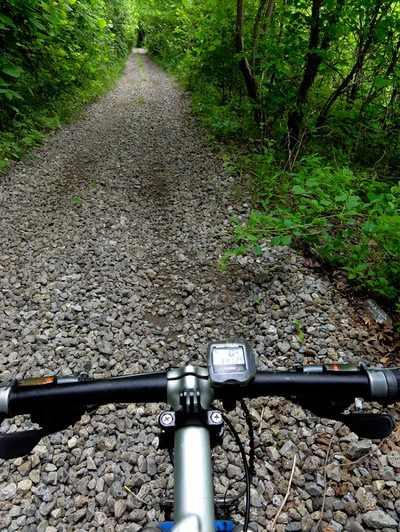
Pulled in and there was the van, with Judy running out, having thought I’d tipped it in the water and was floating downriver to Pittsburgh. Man, I was pretty tired after this paddle. Ate 2 sandwiches after I secured the canoe on the van and that’s when the thunderstorm hit - for like 1.5 hrs straight. We just waited in the parking lot, where I eventually just fell asleep for 45 min. Rain finally slowed down so we left to go back to the West Fork Creek Trailhead where I’d started the canoe this morning. Still raining, but lightly. We got the van turned around and I was on the bike at about 1:30 PM, with a light drizzle and really steamy, humid conditions. The trail starts out as dbl track gravel, and then in a mile turns to asphalt with grassy berm aprons for horse travel, which I knew about from recon. So the going go slow as soon as I got on the berm. It was ok, with my speed at about 7 mph. I remembered the asphalt section to be about 6 miles, so I was counting them down as I rode along, know I’d be treated to dbl track gravel for the final 6-7 miles.
Well, I got to where I figured the gravel to start….and it was freshly paved with asphalt. I shouted out a string of expletives for 2 minutes. Don’t get it…this is West Virginia for God’s sake, in the middle of freaking nowhere and they pave this perfectly good gravel dbl track? What the hell? And the problem was that since the asphalt was freshly put in, the berm were just mushy from construction, with all sorts of gravel ballast mixed in where they laid the asphalt. And I was thinking logically about it, and it was like “how many people get pissed off because the PAVED the trail?” Pretty ridiculous isn’t it? But that was me in my temporary state of insanity when I found out they paved my trail. Got me thinking that they paved the whole damned trail, and if that was indeed the case, the ride would take me like 3 hrs instead of 2.
I was riding with an attitude by then, and it wasn’t a good one. What’s more the drizzle and humidity were just stifling. Riding on that fresh berm was a real chore, and I was just soaked to the bone in sweat and drizzle. And talk about counting down the miles with the mile markers. I lived for those mile markers! Well, to my surprise as soon as the trail Xed into Harrison County the trail turned to dbl track - THANK YOU HARRISON COUNTY WVA! Was able to get it reed up for the last 3 miles, but wow, that addition of paved trail really took it out of me on the fresh berm. By the time I reached Judy in downtown Shinnston I’d decided that my second paddle for the day, about the same as the first, that was a pipe dream. My day was done. Was about 3:15 PM by that point and by the time we drive to do the reverse paddle as we did in the morning, hell, I’d be putting out at 7-8 PM. So I was able to get in just under 30 miles today…Ouch! Hit an Eat N Park for dinner and did the salad bar and perogies. Right now just relaxing with a frosty Yinny. So tomorrow I’m going to split up the paddle I was going to do today, and instead ride this total rat ass trail called the Harrison Rail to Trail, this hideous piece of crap that I did back in 012 when I attempted to do AD. It’s a mud fest that hugs West Fork Creek, which I wanted to just paddle instead. But now, to make up time I’m going to ride the trail and then put in after it ends in 7 miles and do the other 6-7 miles on the water to end in Shinnson. So that’s the plan, then in addition I’m going to do this ATC section that actually bridges the Harrison Rail Trail with the North Bend Trail. Hope to start the North Bend trail on Monday and finish on Tuesday where I’d be at the Ohio Line. That’s my goal right now - the Ohio Line before Tuesday afternoon.
Well, that’s the plan anyway. Now the left leg issue: feels ok paddling and riding, but I limp when I walk. It’s sore for sure. So I guess as long as I don’t have to hike-a-bike, I’m ok. I’m icing it right now. We have a 5-6 day sabbatical coming up from 5/23 to 5/27 because we are going to Judy’s granddaughters graduation in Nashville, so I’m hoping that during that little off period I can get this knee back in business. Then we start back at American Dirt again on 5/28. Until tomorrow….I’m out.