
Saturday, June 20: Well, so amazing to wake up to a non-rain day. Felt as is I was Noah starring out over the remnants of land masses left above water after the flood. So I wanted to get it rolling early today so as to make some real progress through MO. Judy got me in the van and we began driving back to where we entered MO at the Golden Eagle Ferry Xing. So we get on Highway B, and fly down that until we see a road closed sign. And I totally knew what was coming. Hell, back when I did this section in 2011, the Mississippi was in flood stage as it is right now, and the whole Mississippi flood plain on the MO side of the river is prone to extreme flooding down here near St. Louis. Sometimes the whole delta out here is just under water.
And such was the case today. Highway B was closed about 2 miles from where we crossed the Mississippi on Thursday. So I just had Judy drop me off and leave to go back to the cabin to get a workout in and then to get on the bike to come meet me. I was well familiar with the area since I’d done recon here and ridden through this area several times on previous X country trips. Went past the barriers and rode right up to where the waterline was on the road. That’s where I ran into a farmer who was just standing out in the middle of the road looking glumly at his corn crop that was situated in the flood zone next to the flooded out road.
“How long has this been flooded,” I asked him? And he rather rudely replied, “it’s been raining for six weeks now, where have you been?”. I explained that I was riding X country and had just arrived on Thursday during the tropical depression. That’s when he really lightened up, and kind of forgave me for my ignorance. So I stood there for about 10 minutes talking to the guy. And let me tell you, I was really feeling for him. He just looked devastated. “I’ve got insurance on this, but that doesn’t even cover all the time and supplies,” he said, “so I’m loosing about $90/acre.” And he had 100’s and 100’s of acres in that flood zone.
Told him that I’d seen first hand what the farmers do, and what they go through what with the crazy weather every year now, this because I’ve ridden across the country 4x. And believe you me, you ride across the country is it’s more farming and livestock than anything that you see out there for mile after mile. The suburbs - that’s just such a minuscule part of this big beautiful country. Nope, it’s the agg and livestock farmers who represent the vastness of the United States. So it really hit home with me actually talking to someone who’s being impacted directly with this stupid weather. Then he said, “and then the people bitch because the produce is expensive in the shopping markets. Hell, they think this stuff just appears out of nowhere in the supermarket!” And he’s right. We really take it for granted. It’s this guy, and a gazillion more who feed the country, and to me, these folks really symbolize the backbone of America. We parted with a firm handshake, and really, I was beyond words in trying to convey my sympathy. As I rode off on soggy, spongy berm, I just remember seeing this guy standing there like a statue looking across all the acres of flooded corn fields. As I was riding I remembered that he’d told me that the Golden Eagle ferry closing on Thursday evening, and right now it’s undetermined when it will open again. Kind of me me feel good about our decision on Thursday to get out of dodge and X that river before the ferry closed down.
Made it on some real sketchy berm back to the junction with Rt 94. Went left on 94 on even sketchier berm, some just totally eroded away with a 4 foot ditch on each side of the road - this obviously due to past and present flooding. These 30-40 yard sections I had to stay on the asphalt. But this was for a short mile of travel on 94. Then I took a right on Wiedey Road, all a gravel farm road, and just cranked it up to a very wonderful 13 mph. This pup wraps around and eventually crosses the Katy Trail. Got to the Katy, took a right and got er going. And not more than two miles down the trail I hit this trail closed sign - flooding! Yep, right down along the Missouri and on the wrong side of a big levee and it was just totally under water. BUT…having done recon I knew I could ride the levee and rejoin the Katy about 2-3 miles west. Did just that.
Wasn’t simple though, cuz the top of this pup was just a muddy mess. I rode on tire tracks, but I was in the middle ring just spinning through muck tracks and giant puddles. Finally made it back to the Katy after just mudding it big time and ending up coated in muck from my feet to my knees. About a mile later met up with Judy riding east towards me and we rode together back to the cabin. Got in some breakfast, and off we went again, west through downtown St. Charles and west along the Missouri. Judy rode about 30 min with me then turned back to check out of the cabin and drive out to meet me.
Now I had to change my support itinerary today due to all the flooding. I had checked online to see if there was any current areas closed on the Katy, but found none. That still didn’t make me feel secure, because Rt 94, which Judy would use to parallel me, that floods even more than the Katy. The Katy at least sits up high over most of it’s course due to it being an old RR line. But Rt 94, it dips and climbs along the river. So we decided to just go like 10-20 miles max at a time in case one or both of us ran into a flooded out area. First stop on the support itinerary was Matson, some 21 miles west of St. Charles. There were portions of the trail, where it was anywhere from right next to, or like several hundred yards from the trail, and the water was right up to the base of the trail - for miles on end. But there was a steady stream of people coming at me from the west so I felt pretty good about no trail closures.
This portion of the trail, from St. Charles to Augusta, is the most used. Anything east or west of this stretch of trail and usage falls off big time. Now around Weldon Spring, where there’s a big park, this area was about as close to flooding as you could get - the water was a mere 1 foot to 6 inches from lapping across the trail. It was wild to just pedal on this ribbon of land totally locked in by water on both sides. To my left is the Missouri with flooding right up to the trail, and to my right is a low area all along the trail that just collects all the water coming off the northern bluff of the Missouri River Valley.
Made Matson just ahead of Judy. Once she arrived I got a sandwich, powerade and coke, and got it rolling again. I ditched a top and rode topless what with the temp approaching about 88 degrees with off-the-charts humidity. Next stop the town of Dutzow, 14 miles to the west. Got there in great time, with my riding improving to a good 13-15 mph. Just told Judy to keep it rolling to our next stop of at Treloar, another 14 miles down the trail to the west because I was feeling pretty good. But Judy on the other hand, had to take a detour due to Rt 94 being totally flooded over for nearly a mile. The detour was well marked, but we weren’t sure how much of a detour it would be. Later she told me it was steep, narrow country roads that took her a good 15 miles out of the way. As I rode the trail, right next to 94, just to the south, I could see that it had a good 3-5 feet of water covering it. I mean this was extensive. So our plan was working ok, with Judy feeling the brunt of the flooding thus far, but at least having detours available.
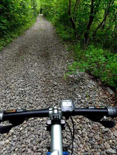
Again, the flooding was crazy, but the trail was dry. And I was lucky enough to not to have to deal with all the deadfall that had just recently been removed from the trail. It too was extensive. But man, this trail is pristine with respect to maintenance. Funny thing to, when I’d go by these yellow “Rough Trail Ahead” signs, it was nothing more than a little loose gravel or some washboaring for 40 yards. I mean with all the total crap I’d ridden through on prior trails, this was just a belly laugh. “Rough,” I thought, “shoot, this is pure heaven!”
Made Treloar in great time, and met up with Judy and a really friendly chap by the name of Sammy, who was the Katy all the way out and back. Judy informed me that there was another closing of Rt 94 just up ahead, but this time there were no detour signage. Got a sandwich and powerade and coke first then went to the maps to see what we could do. Meanwhile Judy got Sammy a sandwich and powerade. I could only see this massive detour on the gazetteer that would add a good 25-30 miles to her 18-mile trip. So after we talked with Sammy for a bit I put the bike in the car and we drove down to where the flooding was. I got out, rode past the barricades on the bike and into the water to check the depth, then, seeing a truck coming at us and going right through the two flood-outs I motioned her on through the two 4-inch deep flood areas. The truck guy even told Judy it was fine, so through it she went with zero issues and no trepidation.
So I motioned her through the other side of the barricades, and then I turned around went back to the trail to make up what I’d not ridden, and as I was riding away I forgot that I had put my pack with phone, flat equipment, and camera in the van with the bike. I had nothing with me for a 20-mile ride to McKittrick. Now I wasn’t freaking, but what if Judy ran into more flooding…with if I ran into flooding…what if I got a flat? That was going through my head like a ear worm. And we were in an area that had very little to no traffic on the trail. So with nothing to do but ride, I cranked it up to super warp speed such that I could get this section down in just over an hour, just in case of flat or flooding or whatever. It just made me ride with a mission. And that I did, feeling amazing by sticking it at a good 18-19 mph for the duration. Biggest ride of the day for me at 80 miles!
Once I reached McKittrick, I was definitely DONE. Temp and hunidity were some high that I was just sweating like I’d come out of a Finnish sauna. We decided to bag it there, and drive the mile across the Missouri to the town of Herman to find a place to stay. The extreme heat and humidity pretty much 86ed any thoughts of camping. I mean it is so hot that you sweat just standing in place! Got a nice little room at this inn with AC and a fridge. So here we sit in the AC as I write the blog. We’ll have some drinks out on the porch area in a few minutes to relax and watch life in a small town. We’re on the second floor, which is kind of cool because we can just look out over the north side of town while catching a nice breeze up higher.
Damn is it nice to just ride again!