
May 5: From junction of Oceola Rd, CR-38 and SR 50/6 NV to five miles southwest on Horse & Cattle Creek Rd. Total mileage was 38 miles in 4.5 hrs of cycling with elevation gain of 2700 ft.
Was feeling a bit better this morning with respect to what I surmise is a mild case of altitude sickness. Still feeling a tad punky with a bit of a nauseous stomach. Morning temps again in the 30’s, but heck, I’ll take these temps out here any day compared to the sizzling summer temps in the 90’s and 100’s! We got going about 7:45 AM to get me back to where I ended up yesterday.
Now I had this brilliant plan that I hatched over the last couple days as I’ve been planning the way we’ll approach this route across the state, and I’d come up with a nice little “shortcut” that looked to save me nearly a day of cycling - based on about 30-40 miles of route to be cut off, and my current daily mileage. I looked this thing over on Google Maps and Garmin Basecamp and on Ride With GPS, and it looked great. Now the roads were unnamed but all the maps showed the same orientation. So I actually drew out a map, measured the distance to the junctions etc. and briefed Judy and Vic on my intentions.
And off I went, having told the ladies that I’d be about 1.5 hrs at the most to cover this thing. So I got to where I’d measured the first right turn to be, about 1.5-2 miles in. Nothing. Went another half mile, and another, and another, and another. Ok, so maybe I measured wrong? Then I see this track to the right, and by sight, I can see it go far out into the basin in just the direction I was heading. Hell, out here you can see for like 8-10 miles in the distance, and I could actually see all the way across the basin to where I needed to exit. So I went right on this ugly set of dbl track that looked like wagon wheel tracks.
Now I was pretty certain I was on the right track as I could see it off in the distance trending directly where I wanted to end up. Only problem was that I began to see two kinds of thorns growing all the hell over this track, one was like these long thorns that were ok while on the plant, but the dead ones, shit, they were like sharp little nails that are fossilized. Then the second, those more resembled a smaller version of the infamous sand burr, but not like three spiked, but more like five or six spiked and nowhere nearly as long and deadly.
So I was thinking, “good move dude, you got yourself right back in the shit zone with all this crap on the track.” I mean there were dead thorns and stuff littered all the freak over this thing. I promised myself right then and there: NO MORE of these tertiary and quaternary roads to ride on. If it’s not named I’m not riding on it. Period! I was pretty uptight as I continued down this track, worrying about flatting out, or worse yet, just totally trashing my tires with hundreds of these thorns. I just kept a vigil on my lines and tried to do my best to stay on the crown of this track to stay away for all the dead stuff that seemed to gather in the actual tracks from washout.
I was like counting down the miles and looking in the distance to see how much further my destination was. Then this bloody track does a 90 degree turn to the north. That got me a bit concerned, what with all the crap on the track. So this thing trended north for a mile and then be damned if it didn’t do another turn - to the east, and it ended at the well head. I yelled out a loud “SHIT!”. Only the jackrabbits heard that one. So there was no way in hell I was going to just bushwhack through all that heavy crap the 5+ miles west to my destination, which I had in full view. Had to go back and reride to track and try again. Did the whole track back to almost the beginning where I found another track, going in my intended direction. Got on that and again - a deadend. Did this a couple times until it hit it right and found a better track with much less of the deadly vegetation. Headed west across the bottom of the basin, and then back up the other side to Rt 93, and in doing so I was in my little cookie, climbing at like 4 mph up through all this loose soil, a combination of dirt and sand. God it was just miserable!
Crossed over Rt 93, rode a very short section of berm, and then found my next track that would take me to where I’d told the ladies to wait for me. Trouble was that I was 2.25 hrs into a ride I’d told them would take me 1.5 hrs. I was kind of concerned that they’d started looking for me in the van, fearing I was dead, stranded, flatted, or God knows what else. Thankfully I saw the van parked up at the top of this little horrible climb and there was Judy walking towards me.
Told them of my fiasco, and swore I’d never do any more of those little shit roads. Looked over my tires and sure enough there were a good dozen of these pricker thorns embedded in the tires, though none seemed long enough to flat me out - probably thanks to Steve installing these tire protectors. Judy and I picked out thorns or a good 10 min as the wind continued to pick up to like 20 mph gusts. Sat in the van half catatonic sucking down a coke and an ice water. Had to put on my polypro top for the next section, which entailed another of my “shortcuts”, but this one was NOT in the crap that I’d just ridden through.
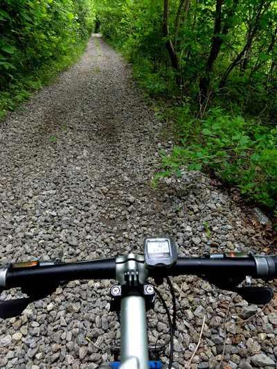
No, this was an old road that paralleled Rt 6/50. I mean it was just below SR 6/50 and it was this completely disintegrated old road, kind of resembling Old AP road in the valley where it’s crumbling asphalt in some area, and then total gravel and sand in another. Had to climb it for nearly 5 miles up to a pass that tops out at 7700 feet, and then it joins back in with the state route. I’d found the name of this old road labeled as NFD-578, and it lined up with my GPS when I started. But later, Garmin said it veered off this old road and down into the brush in this gully that paralleled the old road. NOT! I just stayed on the crumbly old crap road no matter what the GPS said. Climbed at a steady 4-5 mph in the little cookie in the big pie plate in the back, with the wind at my back at over 20 mph. That climb took me an hour - to go 5 miles!
Met the ladies at the pass and slithered into the van like a half dead gecko. And there I was at 27 miles in for the day, at well over three hours of ride time. Managed to eat a pbj and down a water. Had to put on this hoody I had in the van to descend the berm for 5 miles to my next gravel road. Man, what with the wind and the coolness up at the pass, I was shivering for a good 3 miles down the other side. Finally warmed up after dropping 2500 feet of ele. Next up was a left on Horse & Cattle Creek Rd - which had a state prison just down the road a block, on this dbl lane dirt road. It had to be minimum security because it just had some 8 foot high fence with some barbed wire atop it, not that gnarly spiral razor wire stuff you see at most prisons.
Vic later told me the guys were yelling to them from out in the “yard” as they followed me down the road to the south. Headwind had just become an intense, in my face, invisible foe that just beat on me relentlessly for 5 miles. We came to a fork in the road, where I had to go right on what I figured would be a road the van just would be good on, so I pulled the plug at that point. Were I to go any further south I’d be on my own for about 30 miles with no support. That’s the tricky part of this - I have to break up portions such that I don’t end up overcommitting myself to getting in X number of miles a day. It just came at the wrong place and wrong time of day, especially with the wind gusting and howling like hell. So I ended up with 38 miles. I highly doubt if I’d have been able to churn out another 30 after the way I felt. There’s no turning around out here what with no phone service nor any form of communication. If tomorrow’s weather is good I’ll shoot for this unaided section first thing in the morning, get aid, and then add to that about a 15-20 mile unaided section after that for my pick-up point. At least that’s the gameplan?