
Friday, June 26: Woke up this morning to lightening storms….just another day in the life!! With this going on I was in no hurry to get rolling, so Judy did a dumbell workout in the room and I worked. We still got out at a good hour, and got back to our end point at the junction of Oregon and 2400 (I had it down wrong in yesterday’s blog: Oregon NOT Soldier). The sky looked as ominous as it has in past days, with these low hanging, nasty looking gray masses that pretty much were ready to bust wide open at any minute. Wind was out of the northeast at about 15-20 mph. So I got on my bike at 8:30 AM, rode about a half mile north on 2400, and boom, more lightening and rain, and I was back in the van. We had decided to have Judy just stay behind me with the way the weather looked, and this was great because as soon as I got the bike in the van the deluge hit and the thunder and lightening began.
This lasted about 30 min. When things began to clear, I was back out and on the road….and this stint lasted 2.5 miles. Rain and thunder/lightening back, and this time for a good while, like about an hour. I just hung in the van and actually fell asleep just listening to the storm. Judy just sat in the driver’s seat reading her 7th or 8th straight book for the trip. Once the rain and storming stopped I kind of groggily woke up, whereupon I was accused of snoring. Got back on the bike and rode in a light drizzle for another 5 miles…and the storming continued once more.
This one lasted another 45 min. No more sleeping for me. I kind of worked on looking and tweaking the route a bit for the day. Now I’d intended to canoe across the Neosho River, but it was still pretty swollen from the storming that had occurred last week, so that was out. Then the bridge going over the river in Iola, that was out due to construction. So I needed to reroute myself across the river in a different direction. So during all this storming this morning, I’d been trying to ride north on 2400 to junction with South Dakota Rd. Then I’d go west to the very dead end of South Dakota at the Neosho River. Then I’d load the bike in the van, we’d drive north 3 miles, west 3 miles, south 3 miles and 3 miles east, and I’d get out on the other side of the river, just across from where I stopped on the east side at the dead end. What a mess!
So anyway, this I was trying to do for hours during the on and off shower activity. Finally, at that last stop, a farmer stopped next to us to ask if we needed help. Thanked him and told him no, that we were waiting out the weather so I could continue riding. He said, “well, you should be able to ride in about 20 minutes!” And be darned if I didn’t look on my cell at the weather map and he was right, the thing was moving southeast and we were almost at the tail end of the front. Waited another 10 min and I got going in a very light rain just to try to get the jump on a very shortened day already. Made South Dakota Rd, went L and took that through some pretty sloppy gravel road, with my tires kind of sinking ever so little in the road, but just enough to make me feel like I was riding a bit harder than I needed to.
Made it to the end of South Dakota, just at the banks of the Neosho River. Then loaded the bike in the van and did the goofy end around to the other side. Glad I did NOT choose to canoe the river as it looked a bit on the angry side! Got out on the west side of the river after about a 12 mile shuttle. Now you might think this is loco driving all the way to get around the river, but THAT was the shortcut. With Rt 54 closed in Iola across the river, there are only 2 bridges to get around this thing in about 30 miles north and south of the river. It’s a nightmare to try to negotiate across this thing when I cannot do it in a canoe.
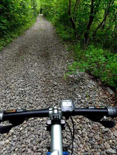
So got going on South Dakota west and that turned into 280th once we got into Woodson County. And this puppy went on and on and on for nearly 25 miles due west, stair stepping up in an endless series of plateaus every couple of miles. Yep, false flat for much with all these stair step climbs that were out of the saddle, middle and little ring, and exhausting with the wet gravel road bed. The next time I hear some knucklehead tell me that Kansas is flat, I’ll personally kick the idiots butt down to 280th in Woodson County! I’d average anything from 5-7 mph while climbing, to 23 mph while descending. But honestly, the up definitely added up to way more than the down.
There was a point where Judy was telling me every couple of miles on this thing how far we’ve gone on 280th, and I finally asked her to please shut her pie hole and let me suffer with dignity! I didn’t want to be reminded how long this thing was, and how many more miles I had to go. Took a good rest break with about 3 miles left in this monster. Did my usual 20oz each of powerade and water, and then ate a bag of fresh Strawberries. Then it was on to the hamlet of Virgil. Took a R on Rt 3 in Virgil, and then stayed on Rt 3 at a little gravel 3-way intersection where we went L, and then the big decision….what to do with the van at the next road?
Then next turn was a L on 270th, and it looked water logged and muddy, and it was more or less dbl track. No way I wanted the van to go through that, and the rest of the roadways I needed to ride on all looked as though, at least from the gazetteer, that they were just like 270th. So I had Judy get on Virgil-Vernon Rd, asphalt, and take that to Rt 99, and then go north to meet up with me as I rode these tiny farm access roads that were thin and muddy. This could very well become more prevalent as we move along through the state of KS, and then well into CO, UT, NV and OR. I just don’t want to put her or the van in harms way, so I have the route set up such that she can have quick access to asphalt while I ride on gravel, and then we meet up at an asphalt junction. Now I’ve got it like this for MUCH of the trip, but not all of the trip. There are still some very tricky areas for me to do such that I can meet up with Judy in a timely manner. Anyway, this was a good test.
So we got her going on the asphalt road to Hamilton, and then up KS Rt 99, while I did this little zig zag course on 232nd, and then onto 290th. Problem was that my gps on the cell calls 290th twp 801, and my Garmin 810 on my bike calls the road two 802. BUT the Garmin gps in the van for Judy, that freaking thing lists the road as 290th. And I didn’t realize this until we had departed one another, and I hit 802. At that point the road sign said 290th, meaning county road 290th, NOT twp road 802. Now my Edge 810 confirmed after all the zigging and zagging that I was indeed on 802. But out there on the asphalt Judy was not going to find that 802 on a sign. Hell no, it will be listed as 290th. And let me tell you, these gravel roads are a bloody maze out here in Woodson and Greenwood Counties. My big worry as soon as I saw that 290th sign was that I’d told Judy verbally and in the itinerary doc, that she should look for 802. SHIT!
Well, with about 5 miles to go on 290th before I would junction Rt 99 I got a call from Judy. And man, I was just stoked that she had service on her cell, because mine, which has much better service, was just barley registering 2 bars. Over a bad connection we could just barely communicate. She had driven 3 miles past the meeting point and could not locate 802. I told her of the gaff, and to go back and look for 290th. Done! I felt much, much better on that last 5 miles knowing that she’d be there at the end with zero drama. Now as far as her riding on the road that I took, 232nd and 290th, well, I think we made the right decision and had her go asphalt. This first 5 miles was pretty sketchy for a non-4WD van. I mean this van is great but it’s not all terrain. The rear end is just so light that it gets stuck pretty easy on soupy, muddy, sticky and tacky surfaces. And there were a couple climbs on 232nd that were just dbl track and fairly muddy from all the rain last night and today. Could have been a nightmare. The last five miles of 290th was great…but you just never know when you’ll hit a swale that’s just too muddy and steep.
I’m telling you from past experience that the gravel and dirt roads out here, some of these are just like the most rudimentary tracks you could think of getting a vehicle on. And we’ve seen signs on virtually all of these soft surface roads warning of flash flooding and low flood prone areas, so it’s serious business making the right call on what the van can and cannot drive on. I’ve really got to be on my A game from here on in.
So I finished with 60 miles today. Now it’s way under where I wanted to be, but hell, I actually didn’t really get riding until after 11 AM what with all the freaking rain. So I ended the day at the junction of 290th and Rt 99 in Greenwood County. We had to drive 16 miles to this little town called Eureka, KS to find a mom & pop motel for the night. I mean we’re way the heck out in ranch country. Most of the woodlands have been replaced by rangeland and grassland. Definitely feel the difference in topography in just 2 days.
Forecast is for good weather for next 4-5 days, with temps going back up into the 90’s by Sunday.